The drone industry has grown exponentially into a $127 billion dollar industry within just a few short years. A segment of that industry that is becoming more and more established is LiDAR enabled drone systems. In 2019 the LiDAR drone market was valued at $38.16 million and is projected to reach a value of $229.55 million by the year 2025. This technology is being used daily on large scale industry projects including construction projects, mining, defense applications, precision agriculture, and corridor mapping for DOT projects.
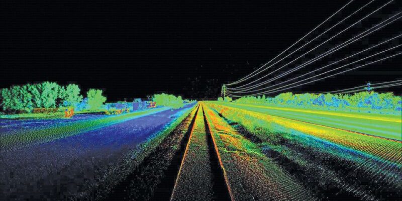
LiDAR (Light Detection and Ranging) is a measurement system that illuminates the target with light using laser and measures the reflected light of an object. Differences in the laser return times allows for the creation of individual points and then be combined into a point cloud. These point clouds allow for the measurement and evaluation of the surface that is being mapped. These models and maps can be valuable tools for monitoring the progress of a construction project, evaluating areas of strategic importance, creating advanced agricultural techniques and planning, and assessing roadway projects future or current.
Drone technologies are enabling industry professionals in diverse areas to optimize and perform tasks better and more efficiently than traditional means. Corridor mapping is currently the largest market share within the LiDAR drone industry. Using LiDAR mapping allows for feasibility studies to be performed before the project is implemented. Instead of spending months evaluating the area manually drone mounted LiDAR can make projects much more streamlined and efficient. This can be applied to before, during, and after of any construction type projects.
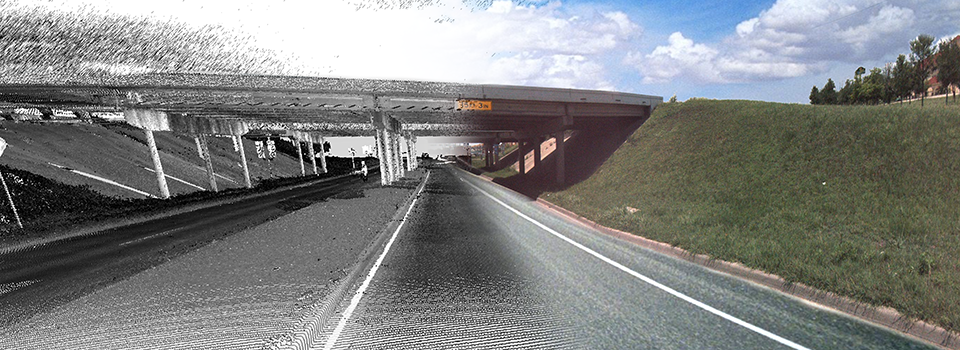
Before drone mounted LiDAR survey crews had to use GPS modules and create this point cloud manually. LiDAR also has a distinct advantage over photogrammetry in that you are collecting actual measurement data with LiDAR as opposed to photogrammetry that is just using photographic data to create 3D models and 2D maps. Pit and pile calculation, acreage measurement, topographical mapping, and 2D/3D modeling using LiDAR can be utilized in mining, construction, agriculture, and more.
Drone mounted LiDAR systems have opened up a world of possibilities for workflow optimization and integration with different industries. As this technology becomes more and more commonplace new uses are being found for its usefulness everyday. Combining the advancements in drone technologies with this exciting new measurement and detection technology will allow us to see more of the world around us more accurately.