As world leaders, the Department of Transportation (DOT) best serves its mandate and mission by employing the most modern methods of data capture while utilizing techniques that ensure maximum operational efficiency.
The effective use of aerial LiDAR and drone technology provides the right cost-saving accuracy for capturing valuable data not only for the needs of today, but also for the future.
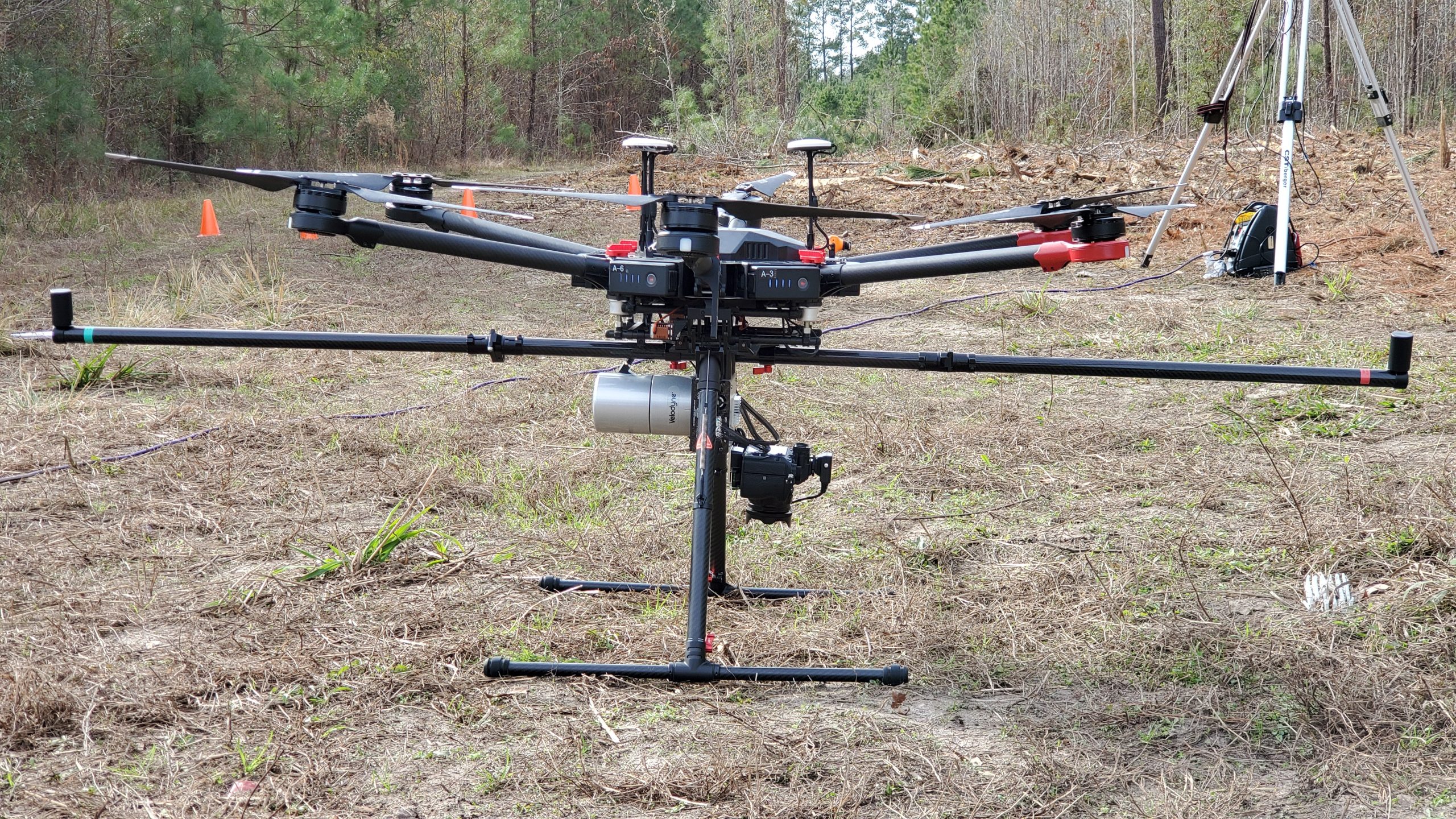
Aerial LiDAR and drone technology are critical for transportation asset management. The ability to accurately record what is on the ground is the first step in keeping operational costs down during an assets life cycle. Drones enable DOT agents to assess highways and other transportation related inventory with tremendous precision. Orthomosaic maps and 3D imagery, provided by drones, offer pinpoint details necessary for maintenance evaluations that can identify problem areas as early as possible. These areas can then be geo-tagged with their exact location for follow-up analysis that can take place years later.
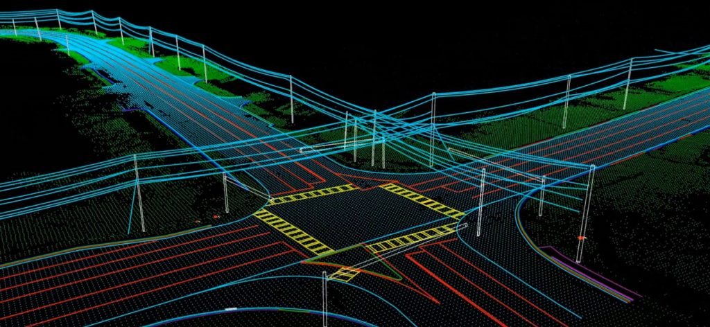
Captured data is only as valuable as its usefulness across departments and platforms. If data is acquired with missing or incomplete information, it means that time is now wasted to go out and collect that data again. This is why civil integration has become more popular with transportation agencies and stakeholders. Drones and LiDAR, when used together, are designed to capture everything. The information collected from drones have universal applications which is essential for agencies and departments that are working less and less in isolation. The design division has to integrate with the construction division which has to integrate with the maintenance division, and both drones and LiDAR technology allow for a single ultra high-definition data capturing mission to be utilized across multiple intra-agency platforms and projects.
A significant amount of time and money is spent on recording existing conditions for the preliminary stage of all DOT highway projects. The use of aerial LiDAR for massively large area data capture and quadcopter drones for minute details in ultra-high-definition has the potential to save the state DOT thousands, if not millions of dollars from unnecessary field equipment, on-site man hours and workman’s compensation. Deploying a drone will reduce field time considerably. One drone pilot, with a visual observer, can complete four projects in the time it would take a field crew to complete one project. When it comes to time and cost, there is no comparison especially when you factor in the speed of the post-production of the 3D deliverables.
Throughout the years, the Department of Transportation has been consistent about looking progressively to the future. When it comes to providing safer and more efficient transportation in America, their commitment to embracing innovation will prove to benefit this generation and generations to come. As a DOT tool, LiDAR and drones are unparalleled when it comes to the reliable evaluation of assets, fully integrable data between project phases and agencies as well as saving state DOT’s a considerable amount of time and money.
It’s nice when you have the data that you want today, but it’s wonderful when you’ve already captured the data that you’ll need tomorrow.